23 Surveying Instruments and Their Uses | Instruments Used In Surveying | Surveying Equipments and Their Uses [Pdf]
![23 Surveying Instruments and Their Uses | Instruments Used In Surveying | Surveying Equipments and Their Uses [Pdf]](https://miro.medium.com/v2/resize:fit:1400/format:webp/0*o-jtiodS1c2BCZlv.jpg)
What Is Surveying?
Surveying is defined as a method of determining the relative position of the points on, above, or below the earth’s surface by taking direct or indirect measurements of distance, direction, and elevation.
Two types of measurements are taken in surveying: Linear measurements and angular measurements. There are different types of surveying equipment used in civil engineering such as Chain, Theodolite, dumpy level, cross-staff, plane table, ranging road, measuring tapes, etc.
Importance of Surveying
- Planning and design of all civil engineering projects require measurements from surveying.
- Execution of work needs surveying too for transferring the points onto the ground.
- Fixing of state and national boundaries also required measurements obtained from surveying.
- Control points can be established with the help of surveying.
- Hydrographical and oceanographic charting and mapping are facilitated by surveying.
- A topographic map of the land surface can be prepared with the help of surveying.
Read More: Top 15 Civil Engineering Software
Types of Surveying
- Chain
- Theodolite
- Traverse
- Triangulation
- Tachometric
- Plane table
- Photogrammetric
- Aerial
Types of Surveying Instrumnts and Their Uses With Pictures
Following are surveying instruments and their uses to carry out surveying.
A. Instruments for Direct Linear Surveying
Measuring Tapes

It is made up of cotton, coated linen, or any other synthetic material. Centimeters or decimetres are marked on the tape.
They are available in length of 20, 30, or 50 meters.
Some of the commonly used tapes in surveying are:
Cloth/linen tape: Available in lengths 10, 20, 25, and 30 metre. Also available in lengths of 33, 50, 66, and 100 feet. A brass ring is provided at the terminal end of this tape. Rarely used nowadays.
Metallic tape: Available in lengths 2, 5, 10, 20, 30, and 50 meters. Except for 2 and 5-meter tapes, other tapes have a small ring fastened at the ends which is of the same width as that of the tape for protection, and are supplied in a leather or metal case with a winding device.
Steel tape: Available in lengths 1, 2, 10, 20, 30, and 50 meters. Except for 1 and 2-meter tapes, other tapes have a small brass ring fastened at the ends. These tapes are supplied in a corrosion-resistant metal case or a leather case with a winding device. It should be handled with care, as it is a delicate instrument. However, its quality and accuracy are far better than the other tapes.
Invar tape: Available in lengths of 20, 30, and 100 meters. Made up of an alloy of nickel and steel with a low thermal coefficient of expansion. Used for linear measurements that require high precision. It should be kept on reels of high diameter as they can be easily bent and damaged.
Surveying Chains

Use
The chain is used to measure the distance on the ground. It gives much more accurate measurement as compared to tape.
A chain is a surveying instrument that is made up of connecting links of galvanized mild steel. The mild steel wire is bent into a ring and joined to each other with three small circular or oval rings. Each connecting link measures 20 cm.
A tally marker or a special joint is also installed sometimes to mark the distance of 5 meters.
The total length of the chain is 20 meters or 30 meters, which also includes a brass handle on each end. The handles are provided with swivel joints for they can be easily turned during surveying without being twisted.
Some of the commonly used chains in surveying are
- Metric chain- Widely used and available in lengths of 5, 10, 20, and 30 meters.
- Surveyor’s chain: Length is 66 feet and has 100 links Widely used for land measurement as 10 square chains make 1 acre.
- Engineer’s chain: Length is 100 feet and has 100 links. Brass tags are installed at every 10 feet.
- Revenue chain: Length is 33 feet and has 16 links.
A chain has to be tested if it is accurate and necessary adjustments are made if not.
Arrow

Arrows are used for marking and are made up of hardened, and tempered steel wire of good quality.
10 arrows are usually sold with a chain. Its length is about 25–50 cm. One of its ends is sharpened while the other end is bent into a circular loop.
To mark the chain length on the ground, an arrow is inserted at the end of the chain.
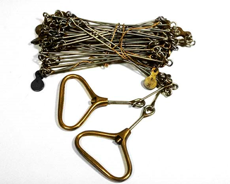
Peg

Pegs are mostly made of timber. They are also used to mark out the locations on the ground at terminal points or the end of the survey line.
They are 2.5–3 square centimeters and are of 15-centimeter length with a tapered end.
A hammer is used to drive the peg into the ground.
Read More: Top 10 Civil Engineering Site Work
Ranging Rods

Ranging rods are 2–3 meters in length and are painted with alternate bands of two colors like white and black, red and white in succession. Each band is kept at a length of 20 centimeters.
Ranging rods are made of well-seasoned timber. Their cross-section is kept either circular or octagonal with a 3 cm nominal diameter.
They are used to range an intermediate point on a survey line.
A red, yellow, or white flag is tied at its top while carrying out longer surveys because the rod is not visible beyond a 200-meter distance.
Offset Rods
It is similar to a ranging rod but is of 3-meter length. They are also wooden rods, circular in cross-section. Its one end is pointed with an iron shoe and at the other, a notch or hook is provided.
It is used to take rough offsets in the nearby regions. Also, the right angles can be set out with its help as it has two narrow slots at its center.
Plumb Bob

Plumb Bob
It is used to transfer the points to the ground on a slope while chaining. It is also used to make the ranging poles vertical.
In theodolites, compass, plane table, and other surveying instruments, it is used for centering purposes.
Read More: Unit of Measurement in Civil Engineering
B. Instruments for Setting out Right Angles
Cross Staff
It is the simplest instrument for setting out right angles on a survey line. It has a frame containing two pairs of opposite slits mounted on a pole. The pole can be used to fix the instrument on the ground.

Cross Staff has three types
- Open cross-staff: Two pairs of vertical slits are present which gives two lines of sight at right angles.
- French cross-staff: It has a hollow octagonal box set up on a pole. On each face, vertical slits are cut in the middle for sighting. The lines of sight are at an angle of 45° to one another.
- Adjustable cross-staff: It has two cylinders of equal diameter with sighting slits placed on each other. The upper box can be rotated and is provided with a vernier to take measurements. The lower box has graduations of degrees and its subdivision. Any angle can be set out with the help of this instrument.
Optical Square

It is more accurate than a cross-staff. Also, it is convenient to use for setting out right angles. It has a circular box with three slits.
The instrument is set on the line whose perpendicular is to be set out. Two slits point towards the ranging rod at the end of the survey line.
Then another ranging rod is to be set at such a point that the two images coincide with each other. This point is on the perpendicular of the initial line.
Prism Square

The principle of prism square is similar to that of the optical square. However, it is more precise as compared to the optical square.
It can be used in a similar manner as an optical square. Unlike the optical square, adjustment is not required, as the angle between the reflecting surfaces does not vary.
Site Square
It has a cylindrical metal case and two telescopes fixed at 90°. It is used to set out offset lines at right angles.
Read More: Thumb Rules for Civil Engineers and Basic Knowledge
C. Instruments for Setting out Directions:
Note: When the direction is established with respect to each other, it is called an angle. If the direction is established with respect to a meridian, it is called bearing.
Prismatic Compass
It comprises a magnetic needle attached to a graduated circular ring made up of aluminum. The needle orients itself to the magnetic meridian if it is on the pivot. Object vane and eye slit are attached to the compass box and help in locating the line of sight.
It is a magnetic compass that measures the magnetic meridian. It is portable and hence convenient too. It can be either used in the palm or fixed on a tripod.

Object vane has thin vertical hair while eye slit has a vertical slit. A triangular prism is also attached below the eye slit to suit different sighting requirements with both horizontal and vertical faces convex.
The south end corresponds to 0° while the west end corresponds to 90° and so on. Thus, the north end is at 180° while the east end is at 270°.
Temporary or permanent adjustments are to be carried out for the compass as required. Centering, leveling, and focusing of the prism are temporary adjustments. The temporary adjustments are to be made every time the instrument is set.
Surveyor’s Compass
The graduated ring is directly attached to the box instead of the needle in the surveyor’s compass. The needle is allowed to float freely over the pivot, but it does not orient itself to the magnetic meridian as in the case of a prismatic compass.

Object vane and eye vane are similar to that of the prismatic compass, however, no prism is provided. The instrument is to be fixed on a tripod.
The readings through this compass are taken against the north end of the needle by looking through the top glass vertically. When the line of sight coincides magnetic meridian, north and south ends are at 0°. While the east and west end correspond to 90°.
Temporary or permanent adjustments are to be carried out for the compass as required. Centering and leveling are temporary adjustments. The temporary adjustments are to be made every time the instrument is set.
Read More: Important point for Civil Site Engineer
D. Instruments for Setting out Angles
Theodolite
It is the most precise instrument for the measurement of horizontal and vertical angles. It is popular in various surveying applications.
There are two types of theodolite- transit, and non-transit. non-transit theodolites have become obsolete these days.
Transit theodolite is such theodolite in which the telescope can be revolved by 180° in the vertical plane.

Parts of transit theodolite include
- Telescope
- Vertical circle
- Index/Vernier frame
- Standards/A frame
- Leveling head
- Two Spindles
- Lower/Scale Plate
- Upper/Vernier Plate
- Plate levels
- Tripod
- Plumb bob
- Compass
- Striding level
Temporary adjustments of a theodolite include setting over the station, leveling, and elimination of parallax. Setting up includes centering with a plumb bob and approximate leveling. Leveling up is done by the screw head- it is either three screw head or four screw head. Parallax is eliminated by focusing on the eyepiece as well as the objective.
